
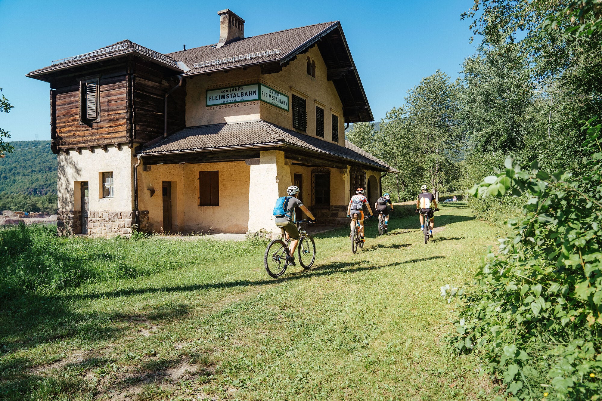
Cyclists work it out within the first few bends: the gradient never changes. No ramps, no walls, no sudden steep pitches. This was never a road — it was a railway, and steam locomotives cannot climb in bursts. The line’s maximum gradient was 42 per mille, or 4.2%, and to keep within it the engineers curved patiently around the hillside instead of attacking it.
The Val di Fiemme railway linked Ora, in the Adige valley south of Bolzano, with Predazzo in the Dolomites: 50.5 km to climb 873 metres, from 224 up to 1,008 metres above sea level. It was built by Austro-Hungarian military engineers during the First World War with one stated purpose: to move an entire infantry brigade from Ora into the Val di Fiemme in twenty-four hours — men, equipment and weapons.
The Ora–Cavalese section opened on 23 June 1917, the extension to Predazzo on 1 February 1918. The line survived the war and was even electrified at 2,600 volts in 1929. Then the lorry won: closure was decided on 10 January 1963 and the track was lifted over the following years. The trackbed remained, and it is now one of the most distinctive mountain bike routes in this part of South Tyrol.
Why ride a disused railway?
Because a railway gradient is calculated for an engine, not for legs — which makes this the most forgiving climb in the area. You can hold a conversation the whole way up, and older children manage it comfortably. The standard ride starts from the car park at the Castelfeder refreshment stop on the SS12 north of Egna and finishes at the San Lugano pass.
The landscape shift. You start at 222 metres on the valley floor and finish at 1,126: nine hundred metres of climbing that is also a complete change of vegetation. Pinot Noir vines give way to chestnut woods, chestnut to spruce forest. That vertical range is what defines this corner of South Tyrol — near-Mediterranean valley floor to genuine mountain in a single morning.
The railway engineering. Tunnels, retaining walls and viaducts: the full line had six tunnels totalling 786 metres, seven viaducts and eight bridges, and the hand of the military engineers is still visible. The finest piece is right on our doorstep — the Gleno viaduct, a stone bridge 73 metres long.
Route data
- Distance: 24.4 km
- Ascent: +929 m (only −29 m of descent: it is essentially all uphill)
- Time: 2 hours 20 minutes going up
- Difficulty: easy
- Elevation: 222 m to 1,126 m
- Surface: gravel track with short asphalt sections
- Start: Castelfeder refreshment stop car park, SS12 north of Egna
- Finish: San Lugano
The route passes through Egna, Pinzano, Gleno, Doladizza, Montagna, Caldaro, Trodena and San Lugano — which means it runs directly past the house.
What you need
A mountain bike or gravel bike with tyres of at least 40 mm. A light: the route passes through tunnels, and some are long enough to go properly dark in the middle. More water than you expect, because there are few drinking fountains along the way. And a windproof layer — at San Lugano you are a thousand metres higher than where you started, and the weather changes its mind quickly.
On e-bikes: not necessary, but with 929 metres of climbing an e-bike puts this ride within reach of people who don’t cycle every week. Regular riders will be fine on a normal bike — the steady gradient is exactly what allows you to pace yourself.
When to go
April to June and September to October are the best windows: comfortable temperatures low down, cool forest higher up. In July and August, start before 9am. The valley floor genuinely gets hot here — that is not a figure of speech, we are at just over two hundred metres in an enclosed valley.
In autumn the chestnut woods turn yellow, and the climb becomes the reason for the ride rather than the means.
Can you get here without a car?
Yes, and it is worth knowing if you are arriving by train. Ora/Auer station sits on the main Bolzano–Trento line, and the trackbed begins close by. That makes this one of the few Dolomite-bound rides you can reach on public transport from Verona or Innsbruck. Check current bicycle carriage rules with the regional operator before you travel.
From Hermann Hof
The old railway trackbed runs through Gleno, so you can get on your bike in the courtyard and join the route without loading anything into a car. Hermann Hof has a locked bike room and an outdoor tap for washing off the mud.
One approach that works well: ride up the trackbed in the morning, stop at San Lugano, then come back down the same way. Descending, the 24 kilometres pass effortlessly — and you actually get to look at the view.
Photo: Thomas Monsorno
Transparency note: this article was written with the assistance of artificial intelligence tools, based on publicly available sources, and checked by our team.